

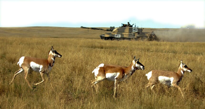
Early in June 1941, two politicians and an RCMP constable carried expropriation notices across the Suffield Block, the shortgrass country northwest of Medicine Hat, and each notice took effect 20 days after it was handed over. After July 1, a family that wanted to go back for its own furniture would need a special permit. Anything still standing might be knocked down or burned.
About 130 families left in those few weeks. That count comes from Malcolm Sissons, a former member of Medicine Hat’s Heritage Resources Committee, who built his account from a family history written by Tom Hulland and held at the Esplanade Archives. The land was going to the Experimental Station at Suffield, a joint British and Canadian site for chemical and biological weapons testing, and Ottawa wanted it empty.
The Hulland place sat at East Springs. John Hulland had come from England by way of Ontario looking for farmland, and around 1937 he put up a house built from lumber salvaged out of a Riverside schoolhouse in Medicine Hat. By 1941 the family held seven quarters of deeded land and leased another 20 quarters for grazing. At 160 acres a quarter, that’s 4,320 acres, or roughly 1,750 hectares, to be cleared in under three weeks (Alberta Tribune’s arithmetic).
Key facts
- Defence Research and Development Canada states that in 1941 the Canadian and British governments jointly procured 2,700 square kilometres of land in Alberta to develop the Suffield Experimental Station as a chemical and biological weapons test facility (DRDC).
- National Defence lists Experimental Station Suffield as opening at Suffield, Alberta, in 1941 (National Defence, Defence research through the decades).
- The Experimental Station in Suffield Memorial Plaque records that the station was established by Order in Council PC 16687 on Aug. 26, 1941 (Veterans Affairs Canada, National Inventory of Canadian Military Memorials).
- Defence Research and Development Canada states that a 1971 Canada and Britain agreement established CFB Suffield and set aside roughly 470 square kilometres of the Suffield Block permanently for defence research (DRDC).
Only three houses left the block in one piece
Most families walked away from their buildings. Sissons counts three homes that were moved out, to Medicine Hat and Redcliff, and the Hulland house was one of them. It went to Crescent Heights, onto a lot that already had a basement in the ground. John Hulland went on farming at Alderson, and the family kept the Crescent Heights house as home until 1954, thirteen years after the notice came.
The block had been thinning out for two decades before the army arrived. It had been controlled by the Southern Alberta Land Company, which was largely British-owned, and that’s why people called it the British Block. By 1920 about 300 settler families lived on it. The dry years of the 1930s took roughly half of them off the land, the same dry-land squeeze that the windmills and pumps at Etzikom’s museum were built to fight. The families still farming there in 1941 were the ones who had outlasted the drought.
They got 20 days.
Most of the old block is still a military range
National Defence dates the station’s opening to 1941, while the order in council that formally established it, quoted on the station’s memorial plaque, is dated Aug. 26, 1941, more than two months after the notices went out. National Defence records that the station later ran progressively larger conventional explosive trials, reaching the equivalent of 500 tons of TNT each in the 1960s. DRDC says it used the land for about 30 years of military testing.
In 1971 Canada and Britain struck a new agreement. Most of the block became the military training area at CFB Suffield, and about 470 square kilometres stayed with defence research as what DRDC now calls its Experimental Proving Ground. The soldiers who volunteered for chemical tests on that grass have a separate story, and Ottawa’s handling of it is laid out in the 2006 order that paid them $24,000 each.
The Hulland account is kept in Medicine Hat
What survives of the families is mostly paper, and some of it sits a short drive from where the Hulland house came to rest. Medicine Hat holds a lot of its own past in plain sight, from the Hycroft china factory to the sandstone Cypress Club, but a ranch family’s history of being moved off the block doesn’t stand on a street corner. It sits in a reading room, and records like it are exactly the kind disappearing faster than Alberta can digitize them.
Tom Hulland’s account is at the Esplanade Archives, inside the Esplanade Arts & Heritage Centre at 401 First Street SE, where the reading room opens Tuesday to Friday afternoons. Out at Ralston, on Dugway Drive, a Veterans Affairs plaque names the Experimental Station and the date it was founded. The plaque says nothing about East Springs. The family history does, in a house’s worth of detail, and anyone who walks into the Esplanade and asks can read it.