

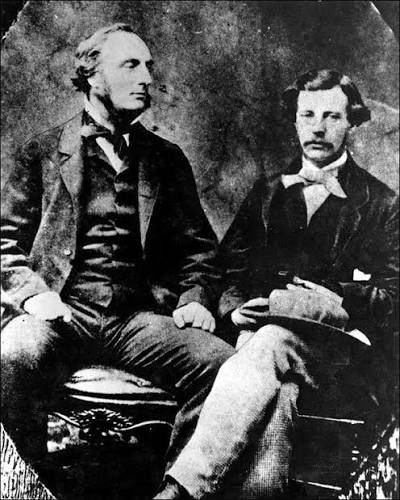
They Rode Through Southern Alberta and Called It a Desert
There is a stretch of Highway 3 east of Lethbridge where the field on your left is a hard, sun-bleached brown and the field on your right is the green of a golf course in June. A canal runs between them. That canal is the only difference, and the whole argument of this column sits in that ditch.
In 1863, the final report of a British scientific expedition told the imperial government that most of this country would never amount to farmland. The men who wrote it were careful, well trained, and honest about what they saw. They were also wrong, and the way they got it wrong is worth remembering every time somebody a long way from here decides what Alberta is good for.
A Grant of £5,000 and Five Men With Instruments
The British North American Exploring Expedition, which almost nobody calls by that name, set out in 1857 and worked through to 1860. Captain John Palliser, an Irish sportsman who had already hunted his way across the American plains, pitched the idea to the Royal Geographical Society. The Society made it scientific, the imperial government put £5,000 behind it, and the Colonial Office added the old fur trade canoe route west of Lake Superior to the assignment.
Palliser took four men. James Hector was the geologist and surgeon, a 23-year-old Edinburgh medical graduate. Eugène Bourgeau collected plants and was very good at it. Lieutenant Thomas Blakiston carried magnetic instruments in by way of Hudson Bay. John Sullivan kept the astronomical observations and the accounts. They wintered near Fort Carlton, then near Edmonton, and in the summers they split into branches and fanned out across country that London had never properly mapped.
The Packhorse That Named a Mountain Pass
On 29 August 1858, Hector’s party was hauling a packhorse out of a river west of the Bow when his own horse wandered off. He went after it and took a hoof to the chest. He went down and stayed down. His companions, by the account that has come to us, started digging a grave before he came around.
He named the river the Kicking Horse. The pass above it took the same name, and 23 years later the Canadian Pacific Railway chose that corridor to get through the mountains. It sits at 1,627 metres and remains the highest point on the line. A bad afternoon with a horse ended up on every railway map in the country.
A Verdict Written in a Dry Year
The expedition’s reports divided the prairies in two. North of the North Saskatchewan lay a fertile belt, good soil, enough rain, fit for settlement. South of it lay a triangle of semi-arid grass that the record described as land that would “forever be comparatively useless” for crops. Grazing, maybe. Wheat, no.
Peer-reviewed work published in 2013 reconstructed the conditions the party actually rode through. Precipitation was below normal across those seasons. Grass fires were common, herds had cropped what grass there was, and the ground looked exactly as barren as Palliser said it looked. He described a dry decade and filed it as a permanent condition.
Then John Macoun crossed the same ground in the 1870s during a wet run of years and reached the opposite conclusion with equal confidence. His optimism supplied the agricultural case for running the railway south through the very triangle Palliser had condemned. Two careful men, two honest reports, two snapshots of a place that refuses to hold still.
What the Triangle Grows Now
Southern Alberta answered the question with concrete. The Brooks Aqueduct carried water across a valley on a three-kilometre concrete trough. The Lethbridge Viaduct put a railway over the Oldman. Districts formed, headgates went in, reservoirs filled.
Today there are 13 irrigation districts in Alberta working about 1.7 million irrigated acres, roughly 70% of all the irrigated land in Canada. Those acres make up 4.4% of the province’s cultivated land base and produce 28% of Alberta’s total agri-food GDP, worth $5.4 billion annually to the provincial economy, $3.2 billion in labour income, and about 46,000 full-time equivalent jobs. In 2020 the districts, the province and a federal lender committed more than $930 million to modernize the canals and add acres.
None of that came from better weather. It came from people who looked at Palliser’s verdict, disagreed, and spent a century moving water.
The lesson is not that experts are useless. Palliser’s map was the best in existence for decades and his geology still holds up. The lesson is narrower and more Albertan than that. A place is not what a visitor sees in a dry year. It is what the people who stay decide to make of it.
What else about Alberta do you think has been judged by people who only passed through?