


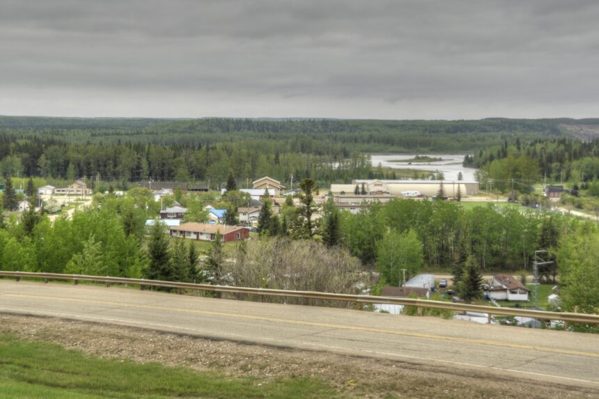
If you want to argue that Alberta is a freight province by inheritance and not by accident, the best historical exhibit is Fort Assiniboine. The post was built in 1823 on the south bank of the Athabasca River for one specific reason. It was the northern transfer point on the Athabasca Trail, the overland horse route that ran roughly north from Fort Edmonton. At Fort Assiniboine, brigades took the cargo off the horses, loaded it into canoes, and continued north into the Mackenzie River system. That is the working definition of a multimodal freight hub. Alberta had one in 1823.
1823 on the Athabasca
The Hudson’s Bay Company put the post in. The site sits at the modern village that still carries the Fort Assiniboine name. Parks Canada lists it under Canadian Register ID 17704 and the Historic Sites and Monuments Board of Canada designated it a National Historic Site of Canada on May 29, 1935. The post operated for most of the nineteenth century before the railway began to reorganise western Canadian logistics.
The Athabasca Trail runs north from Edmonton
The Athabasca Trail was the working overland corridor between the two largest river systems serving the western interior. The North Saskatchewan ran east. The Athabasca ran north. Connecting the two required a horse trail across the muskeg country between Edmonton and the Athabasca River. HBC brigades pushed up the trail with carts and packhorses, switched to canoes at Fort Assiniboine, and continued north to Lesser Slave Lake, the Peace, and onward to the Mackenzie watershed.
Horses out, canoes in
The transfer point logic was specific and unforgiving.
- The post had to be at a river deep enough for canoe brigades to launch in spring melt and run reliably through the open water months.
- The post had to be on stable enough ground for cart and packhorse offload.
- The post had to have enough warehouse capacity to hold cargo during the few weeks each year when the trail was passable but the river was not, or the other way around.
Fort Assiniboine fit all three. The site was chosen by people who understood that logistics is geometry plus weather, and they got the math right.
Why this transfer point shaped western trade
For roughly fifty years, almost every piece of cargo moving from the HBC’s central depot at Edmonton to the company’s northern posts on the Mackenzie River system went through Fort Assiniboine. That includes trade goods, personnel, mail, supplies for missions, ammunition, food, tools, paper. The post is a small footnote in most histories. The corridor it served is the original Alberta export route to the Arctic basin.
Reading the map of modern Alberta backwards
Take a modern Alberta map and trace the freight network. Highway 16, Highway 43, the CN main line, the proposed Pacific bitumen route, the existing pipelines, the railway lines that feed grain terminals. The geography keeps repeating the same lessons. Distance is real. Goods move. Transfer points pay rent. Whoever controls the connection between two transport systems controls the value that runs through both of them. Fort Assiniboine knew this in 1823. The modern province is still working out the implications of the same idea.
The original village is small now. The post is archaeological. The Trail is partly road and partly grown over. The principle is in the same place.
Listed on the registry. Fort Assiniboine appears on the Canadian Register of Historic Places as Site ID 17704 and was designated a National Historic Site of Canada on May 29, 1935.
Related reading from the series. Jasper House and the Athabasca Pass provisioning route. Fort Augustus and Fort Edmonton, the rival posts that founded the capital.