

Key facts
- The first geocache was placed on May 3, 2000, by Dave Ulmer near Beavercreek, Oregon, days after the US government switched off GPS selective availability and civilian receivers became accurate enough to find a hidden container.
- The game turned 25 in May 2025: more than 3 million active caches in 191 countries, with 642 million “found it” logs recorded.
- Alberta Parks lists geocaching as a permitted activity at Kananaskis sites including Spray Valley, Bragg Creek, Sheep River, Highwood, Jumpingpound Creek and Old Baldy Pass.
- Where Alberta Parks has granted permission for caches, the standing condition is plain: stay on designated trails, and no items removed or left at the site.
“Geocaching.” That is the whole line. It sits on the permitted-activities list for park after park in Kananaskis, between fishing and mountain biking, and it represents the best tourism bargain in the province. Alberta already has a volunteer-built, volunteer-maintained network that sends visitors to coulees, ghost towns, viewpoints and small-town main streets. It cost the public purse nothing. Almost no town markets it.
The network is volunteer-built
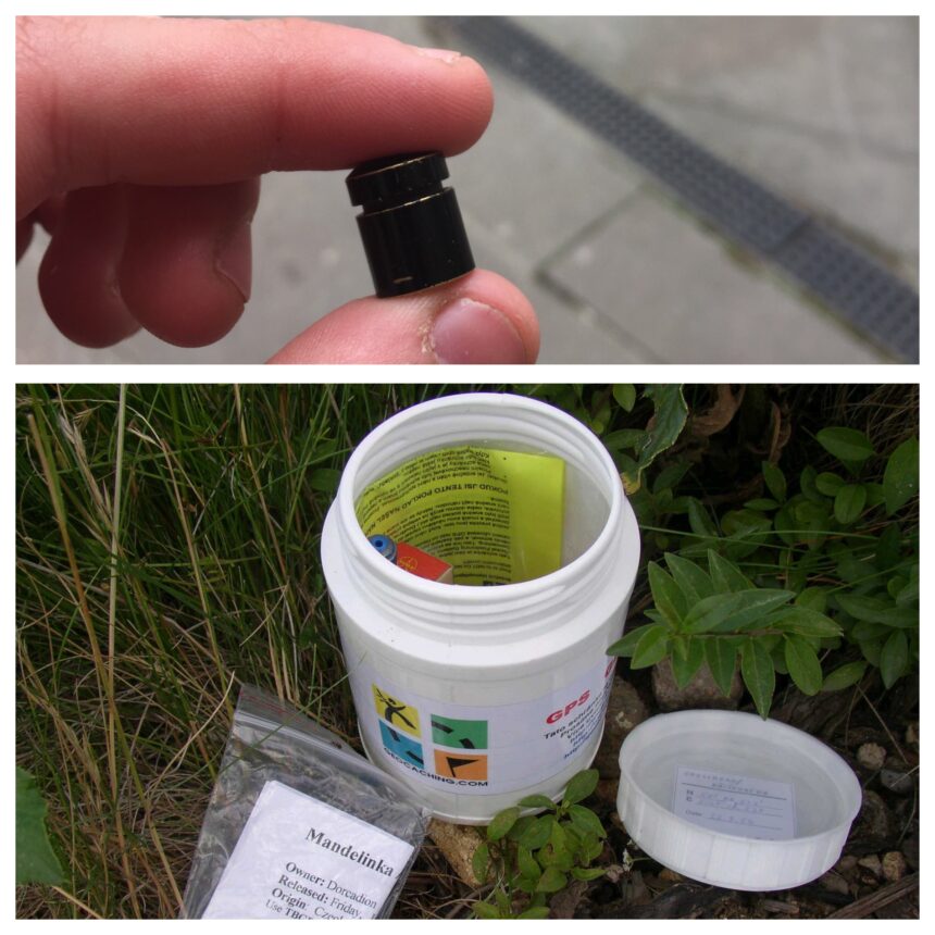
Geocaching is simple. Someone hides a container, posts the coordinates, and strangers come looking. The container holds a logbook. The finder signs it and logs the find online. That is the entire game, and it has run for 25 years on volunteer labour.
The scale is what matters for a town council. Three million active caches in 191 countries. Hundreds of millions of logged finds. A dedicated community of players who plan trips around cache density, who drive to places they would otherwise never see, and who spend money on fuel, food and beds while doing it. Every cache in Alberta was placed by a volunteer, is maintained by a volunteer, and draws visitors at no cost to any municipality.
Geocaching costs a town almost nothing
Only attention. A cache costs its owner a waterproof container, a logbook and an afternoon. The province’s contribution is permission, which Alberta Parks has already granted across much of Kananaskis. The town’s contribution could be a page on its website: the local caches, the walking route between them, where to eat after.
Compare that with the standard rural tourism playbook. An interpretive centre costs millions to build and hundreds of thousands a year to staff. A geotrail costs a web page and a relationship with the local caching community. One of these already connects places visitors already seek out, in every coulee in the province. The other exists in the grant application pile.
The permission model already works
The permission model works. Alberta Parks allows geocaching across its Kananaskis sites with clear, minimal conditions: stay on the trails, leave nothing, take nothing. That is the entire regulatory burden, and it has held for years. The caches bring hikers to trailheads in every season. Nobody had to build anything.
The gap is marketing, not infrastructure. Ask a town office how many geocaches sit within its boundaries and you will usually get a blank look. The map exists. The visitors exist. The connection between them does not, because nobody has been assigned to make it.
A cache asks almost nothing of a place
The standing condition where Alberta Parks has granted permission is plain: stay on the designated trails, and no items removed or left at the site. The Kananaskis Karst earthcache, granted permission by Alberta Parks, carries exactly those terms. An earthcache does not even hide a container. It asks the visitor to look at the rock, answer a question, and log the find.
For a town, the ask is equally small. The caches are already hidden. The players already come. What is missing is the invitation: a page that says these caches exist, this is the walking route between them, this is where to eat after. The game even has a built-in anniversary to market around. It turned 25 in 2025. A town that had promoted a “25 years of hidden Alberta” trail would have been selling something no competitor could copy, because no competitor has your coulees.
Towns capture what parks attract
The parks provide the setting and most of Alberta’s tourism draws. The towns capture the spending. A cacher who drives to a Kananaskis trailhead may buy fuel in Bragg Creek, lunch in Cochrane and a bed in Canmore. The park collects the conservation pass fee. The town collects everything else. That is why the marketing belongs at the town level: the town is where the visitor’s wallet opens.
A geotrail also does something an interpretive centre cannot. It moves. Caches get archived and new ones get hidden. The trail refreshes itself every season on volunteer labour. A town that publishes a geotrail this spring will have a different, larger trail next spring, at no additional cost. That cost curve is hard to match in tourism.
A town can start in three steps
Three steps. First, check the geocaching map for your town and count what is already there. Second, ask your tourism board, your economic development officer, or your chamber what it would cost to promote the caches: a page, a printable trail, a line in the visitor guide. Third, talk to the local cachers before you publish anything. They built the network. They know which caches are worth the drive and which ones are a film canister under a lamp skirt.
Do it before the next budget meeting, not after. The network is already built. The volunteers already did the work. The only thing missing is a town willing to put its name on it.